Photo captured by game camera.


Photo captured by game camera.
Interested in restoring wetlands and/or creating a duck hole on your property, but not sure if it’s possible? Each year, the USFWS Partners for Fish and Wildlife Program (Partners Program) and our associated agency and conservation partners field many inquiries from landowners interested in building wetlands. We have the tools to help!

With the advances in modern technology and online mapping tools, the Partners Program can quickly study a property’s features and determine feasibility of a wetland project. When a landowner calls or emails, the responding Partners Program biologists utilizes a four-step process to assess a property for wetland restoration potential:
Step 1: The advances in aerial imagery have made virtual property assessments quick and comprehensive. With Google Earth imagery, we can view the current image of a property and look back through the last 40 years to see changes on the landscape and recurring dark spots (or wet spots) in a field. The imagery is so detailed that we can see tile lines, drainage ways and even the occasional tile inlet. Once Google Earth shows us the potential wet spots, we take it one step further by viewing the early 1940s imagery to visualize the landscape before modern agriculture practices and development drastically changed the land.

Step 2: If both Google Earth and the historical imagery consistently show the same wet spots, we pull up soils maps from Websoil Survey. Websoil Survey is a great resource for landowners and land managers. This webtool shows the soil types of an area of interest and populates a report explaining the soil qualities. Certain soils are “well-drained” and are not ideal for a wetland project. Other soils are “hydric.” Hydric soils are the perfect soil type for wetland restoration projects.

Step 3: We then utilize LiDAR imagery, which stands for Light Detection and Ranging, to assess surface features of the land. Lidar is technology that uses a laser scanner to create high-resolution models of ground elevation. We use mapping software to evaluate the models and determine elevations, depressions, drainage areas and vegetation cover. From these features, we can draft a preliminary wetland design.
Step 4: An important, yet often overlooked, step for assessing properties for wetland restoration is checking with Mother Nature. We wait for a big spring rain, then make a quick trip to the property in question. A 1- to 2-inch rain in April is a great tool for assessing wetland potential. An on-site visit after a spring rain is a good time to locate components such as tile inlets/risers, tile outlets flowing into creeks and drainage ditches and tile holes. These are all indicators of wet spots in fields.
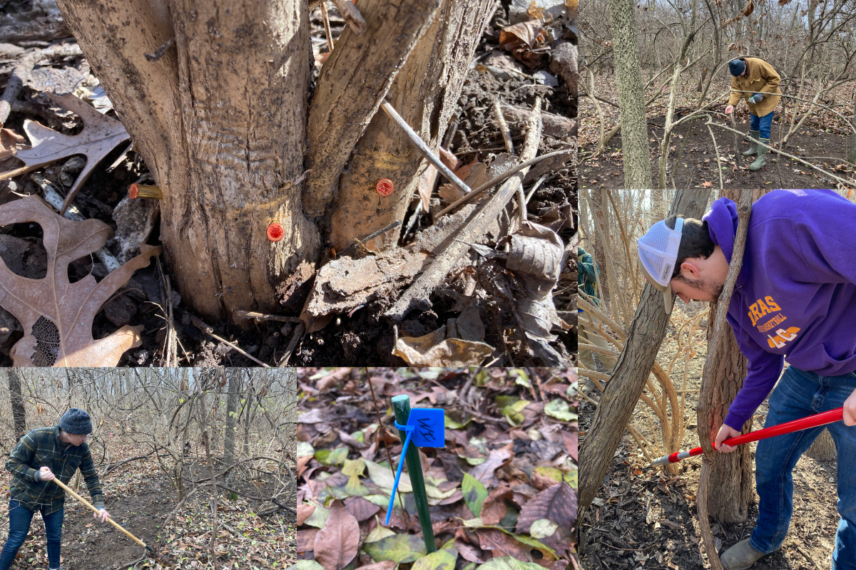
If the results of our four-step process indicate wetland restoration potential, an on-site detailed topography survey will be completed to finalize a design and provide cost estimates. Some projects are as simple as crushing old clay tiles and/or installing water control structures. Other projects take more dirt work to construct small berms or shallow scrapes. Once a design and budget are finalized, the landowner agreement will be completed, and local contractors hired.

There you have it! As quickly as you can send us an email with the location of your property, we can utilize these online tools to assess the feasibility of a wetland project.
As the program name indicates, the USFWS Partners for Fish and Wildlife Program in Illinois is a partnership program and team effort between private landowners, the Illinois Department Natural Resources, Ducks Unlimited, Pheasants Forever, Quail Forever, The Wetlands Initiative, local conservation groups and communities who want to experience more wildlife, better water quality, reduced flooding and nutrient pollution, and improved soil health on the landscape. The next articles in this series, will discuss the actual processes of wetland restoration and construction, long-term wetland management and invasive species control.

If you’re interested in restoring wetlands in east-central Illinois, contact Jason Bleich at jason_bleich@fws.gov to get started. If you’re interested in restoring wetlands in the Illinois River Valley or western/southwestern Illinois, contact Emily Hodapp at emily_hodapp@fws.gov. If you’re interested in restoring wetlands in northwestern/northern Illinois, contact scott_james@fws.gov.
Jason Bleich is a Private Lands Biologist for the U.S. Fish and Wildlife Service (USFWS) in Illinois. He has worked with private landowners the majority of his 16-year career in natural resources, including Pheasants Forever and the Ford County Soil & Water Conservation District. Originally from Illinois, Bleich has had the opportunity to work in multiple states including Arkansas, Iowa, and Missouri before returning to his hometown in east-central Illinois. Bleich is excited to continue working with Illinois landowners and conservation partners in his role with the USFWS Partners for Fish and Wildlife Program.


Submit a question for the author