
A 260-year-old witness tree standing in northern Illinois. Photo by John Nelson.

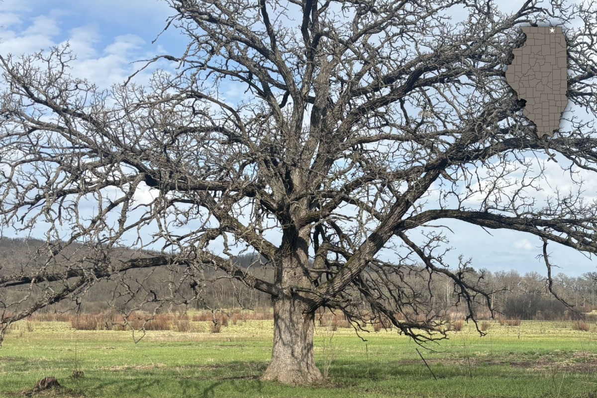
A 260-year-old witness tree standing in northern Illinois. Photo by John Nelson.
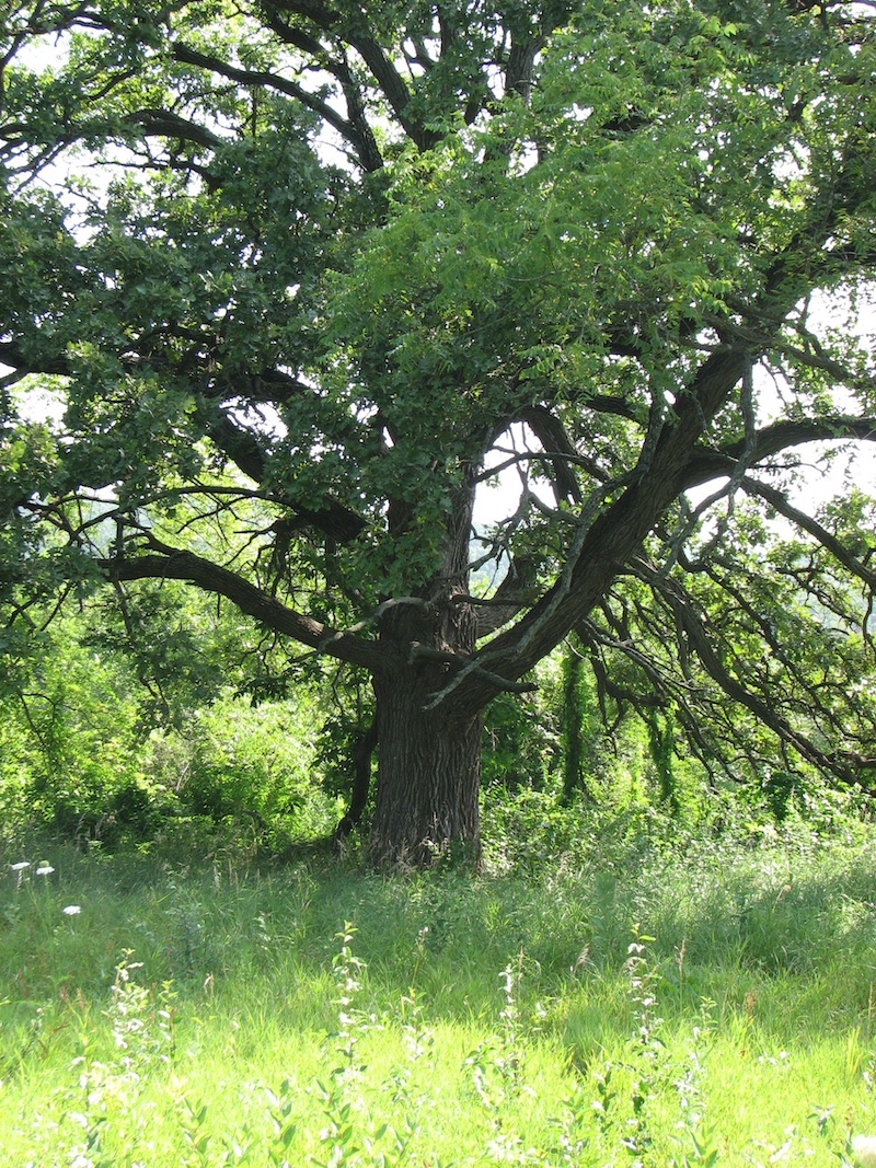
Just beyond the outskirts of Chicagoland, near the town of Woodstock, stands an old and majestic bur oak. Its branches are long, strong and stretch outward – a result of growing without competition from other trees. Its trunk measures more than 43 inches across, far too wide for me to wrap my arms around. Its crown provides more than enough shade to shelter our entire group of hikers from the sun. It’s easy to imagine cattle basking in the shade of this tree when northern Illinois and southern Wisconsin were part of one of the most productive dairy regions in the world.
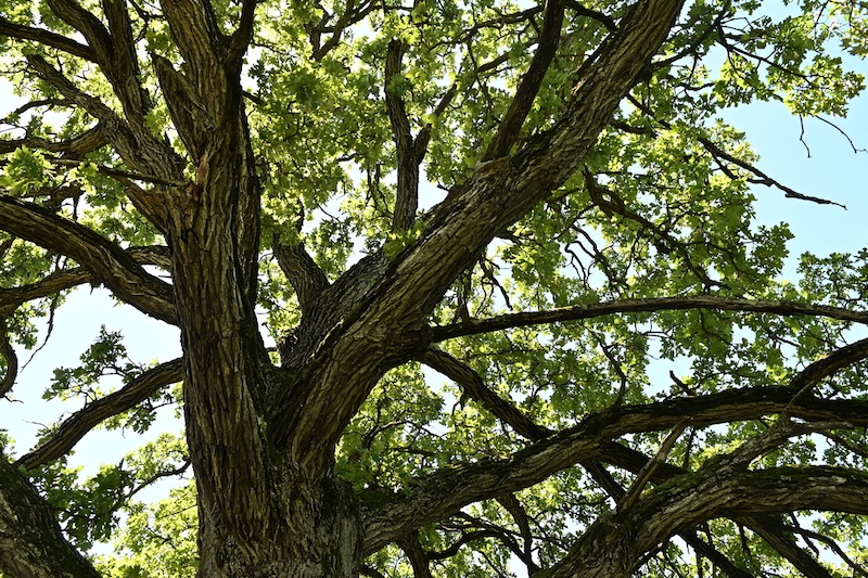
This majestic bur oak is unusual not for its size, but because it is a witness tree, meaning that it was recorded by the first land surveyors of the federal government who sub-divided the land for newly arriving settlers. Few living witness trees remain across the Illinois landscape because they have been cut down or died. Experts estimate this witness tree is more than 260 years old, older than the very nation in which it stands.
The earliest documentation we have for this witness tree is from surveyor’s field notes and a plat map from 1837. The Public Land Survey (PLS) occurred in the Illinois Territory from 1804 to 1843 and still governs all legal land descriptions within the state. Surveyors working for the United States General Land Office carefully mapped and took field notes when Illinois was a vast and relatively intact wilderness. That is what makes these survey records so valuable, because it was a systematic survey of conditions prior to the widespread landscape alterations that would quickly follow European-American settlement.1 These maps and notes would be used by the early Europeans2 to find their land claims and are now among the “most accurate and scientific descriptions” of Illinois land before the settlers.3
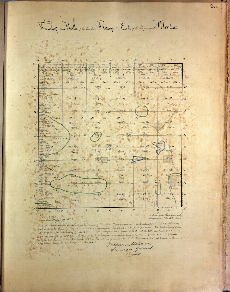
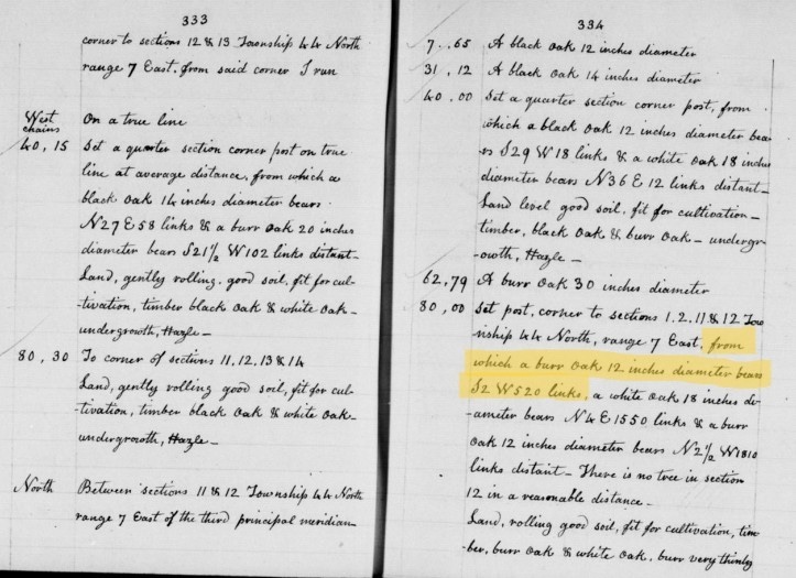
The General Land Office Surveyors employed a new rectangular grid system that was a radical departure from the ‘meets and bounds’ survey methods employed in the original 13 colonies. The new grid system sub-divided land into townships consisting of 36 one-mile square sections. Each section corner was “monumented.” When trees were available nearby, surveyors erected a post at section corners and recorded witness trees in their field notes. These notes recorded the compass heading, distance, species of tree and its diameter.4 In this part of Illinois, oaks such as white, bur, and black, were most frequently recorded in field notes. Additionally, township plat maps identified key landscape features such as timber, prairies, wetlands and streams, while notes described vegetation type and if the land was suitable for agriculture.3
Township 44 North of the base line Range 7 East of the 3rd Principal Meridian (abbreviated as T44N, R7E of the 3PM), now known as Dorr Township, is the plat map for this area. The field notes scribbled in messy cursive record the bur oak as witness to the corner of sections 1, 2, 11 and 12. Its trunk measured 12 inches in diameter in 1837, and it was located at a distance of 520 links (343 feet) from the section corner. The valley floor was described as “wet prairie” and “too wet for cultivation.” And Boone Creek was mapped as a meandering stream flowing eastward across the valley floor. Portions of the valley floor were later converted to row crop agriculture, but wet conditions must have made farming difficult, as these areas were abandoned in the 1960s. Our witness tree survives today, in large part, due to its location along the section line. Such a location, between adjacent property owners and along a common fence line, must have been seen as an asset for cattle to rest beneath while they seasonally grazed on prairie and wetland vegetation. As a result, the witness tree was left alone to grow into the majestic tree we see today.
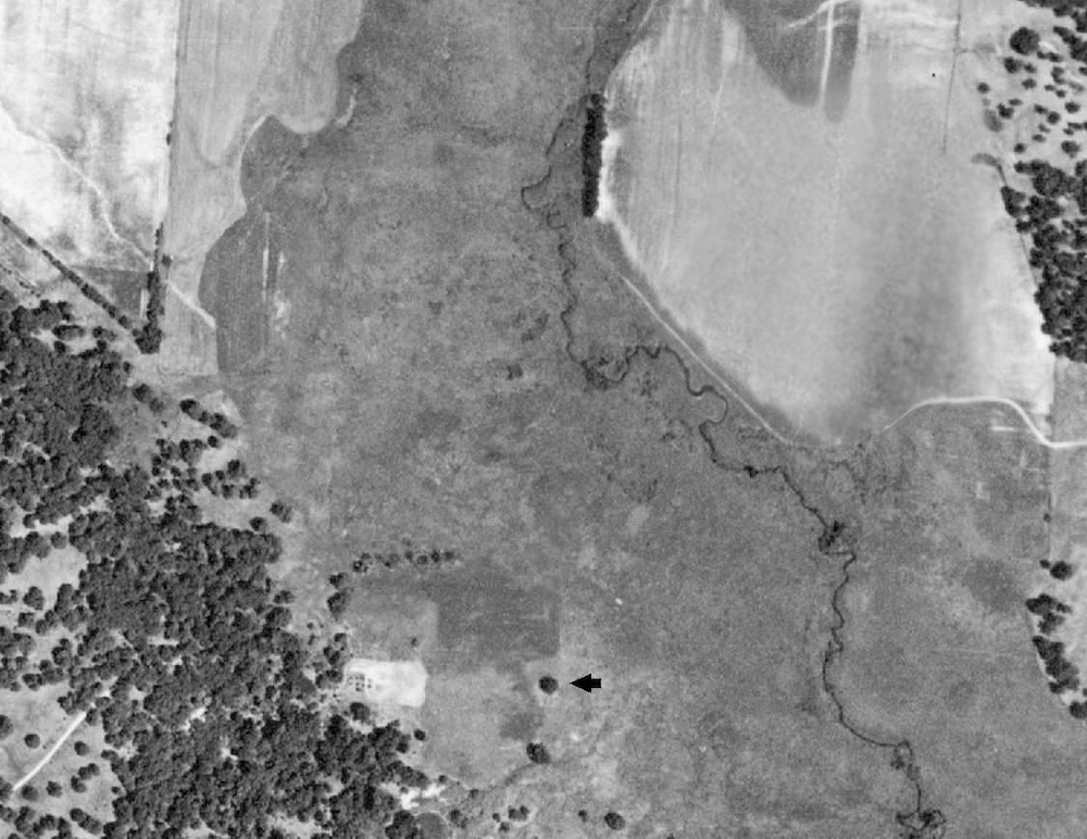
Aerial photographs taken in 1939 as part of the Agriculture Adjustment Act of 19335 show that the landscape surrounding the witness tree was similar to what the original land surveyors saw in 1837 and consisted of wetlands, prairies, savannas and woodlands. They would have recognized the place. Since 1939, however, invasive trees and brush have invaded portions of the landscape where our witness tree stands. By the 1970s, despite the fact that the landscape was suffering due to neglect and lack of fire, high-quality natural communities survived.6
While chance circumstances—wet soils and otherwise arbitrary boundaries—may have protected this tree for 100 years, its survival today is part of a larger land preservation effort. This witness tree sits within Boone Creek Fen and Seep Illinois Natural Areas Inventory (INAI) site, which identifies some 468 acres of land consisting of high-quality natural communities of statewide significance.6 The INAI is administered by the Illinois Department of Natural Resources and is updated continuously, subtracting when sites become too degraded or adding sites that qualify for designation due to the presence of high-quality natural communities and/or for habitat of state-listed plants or animals.
The Boone Creek Fen and Seep INAI site designation allows a “pathway” for landowners to protect their land within the Illinois Nature Preserves System. Over the last 25 years, several private landowners have legally protected more than 300 acres as part of the Boone Creek Fen Nature Preserve. Under state law, these dedicated lands are protected in perpetuity and are to be maintained in their natural state. This is the highest form of legal land protection within the state. In 2024, the IDNR purchased a 150-acre “key” parcel of land in the middle of the privately dedicated properties to unify the preserve. Stewardship is overseen by the Illinois Nature Preserve Commission, which works closely with landowners to provide direction and maintenance and recommend best practices.
Today, the preserve is home to multiple rare, high-quality, intact ecosystems: relict woodlands, savannas, relict sedge meadows, wet prairies, fens, springs, a stream and seeps. Highlights of some of the communities are:
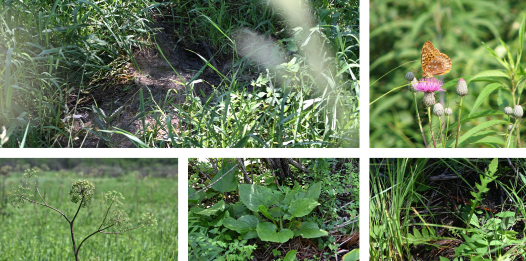
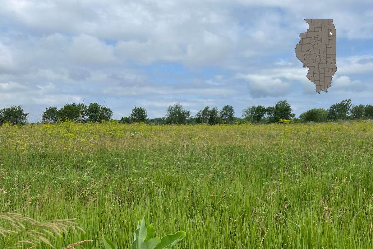
Boone Creek Fen Nature Preserve is located within a larger area known as the Northeastern Morainal Natural Division of Illinois, an area shaped by the retreating Wisconsinan Glacier and characterized by geologic features such as end moraines, ground moraines, kettles, kames and glacial lakes. These formations and the ability to retain water changed the landscape and resulted in a diverse array of unique ecosystems such as fens, wetlands, bogs, natural lakes, dunes, sand prairies and sedge meadows.13, 14, 15 Some of the most threatened habitats in Illinois are found right here, in the Chicagoland area.16, 17
I was incredibly fortunate to get to visit the witness tree, having been invited to join a group that would meet and enter the Nature Preserve by hiking across private land. Finding the place required some patience. The smartphone apps that I’ve come to depend on were of little use there. I veered from the main road onto gravel, and from there the road branched off like the limbs of the majestic witness tree. There were no obvious road names, just directions based on landmarks. “Take the middle road.” “Go past the stable.” It was no wonder I was the last to join my group.
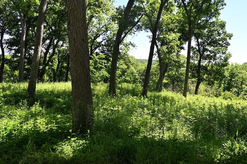
After gathering at our meeting point, we began to hike. We first came to a woodland area located high on the edge of a moraine – a large mass of rocks, soil and debris that was deposited by glaciers some 10,000 to 15,000 years ago. From these heights, I looked across the land below and began to imagine how these lands were shaped and formed as massive glaciers moved, melted and hardened, pushing and carrying sand, rocks and boulders, big and small, to form a massive ridge. At one time the ancient Fox River flowed through the valley below,11 but now it is occupied by the tiny, groundwater-fed Boone Creek. The top of the moraine is speckled with white oak trees.
It had rained the day before my visit, one of those continuously heavy and windy, almost torrential, storms that Chicagoland experienced this past May and June. Yet, on the uplands, the ground was completely dry, suggesting that the sandy soil is porous and drains well.
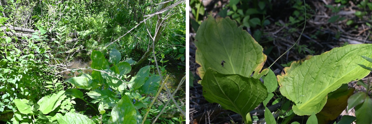
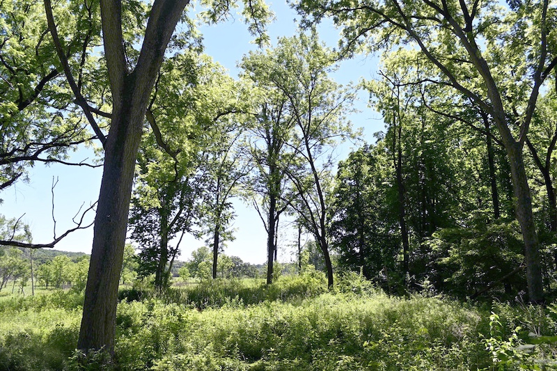
Once we hit the halfway mark of the slope, however, it all changed. The woodlands transitioned into a full canopy forest with some places on the ground covered in a blanket of skunk cabbage. The ground was soft, black and wet. We were looking at a forested seep, a community of plants fed by a continuous supply of groundwater. A layer of clay beneath the ground prevents water from percolating down any further and forces the water to move laterally as a perched water table or aquifer. Spring runs, small, cold-water streams, flow from these seeps down to the valley floor below. Along the spring runs we find marsh marigolds and numerous species of sedges.
There are, in fact, two aquifers in this preserve, with the other located beneath the valley floor. These two aquifers are the primary source of water that sustains the wetlands within the valley and feeds Boone Creek. This underground water system is the “lifeblood’ the seeps, fens, sedge meadows and wet-prairies of the valley. Such an intact groundwater system, flowing through relatively undisturbed sand and gravel deposits, is increasingly rare in northeastern Illinois today due to mining and intense land development.11, 6
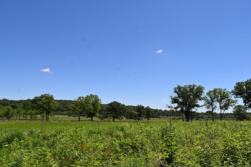
At the end of the dense canopy forest, we walked on flat wooden planks lined up to form a wide crossover to bypass the gushing cold-water spring run that originated from the perched aquifer. This large force of water travels downhill and conveys an estimated 250,000 gallons of water per day! This was the first of many spring runs encountered on our hike, with the rest small enough to hop over.11
The land opened to an oak savanna and provided the first glimpse of the magnificent witness tree off in the distance. This sprawling mighty oak stands within a cluster of neighboring walnut trees and is hard to miss.
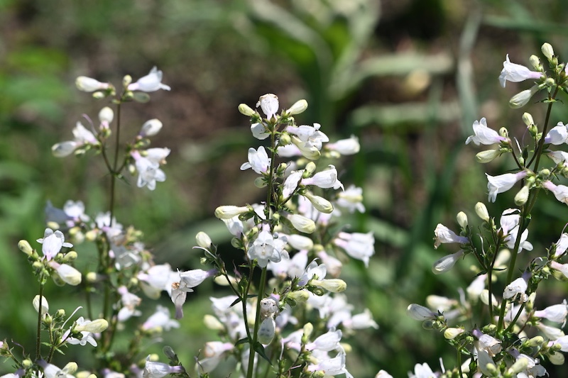
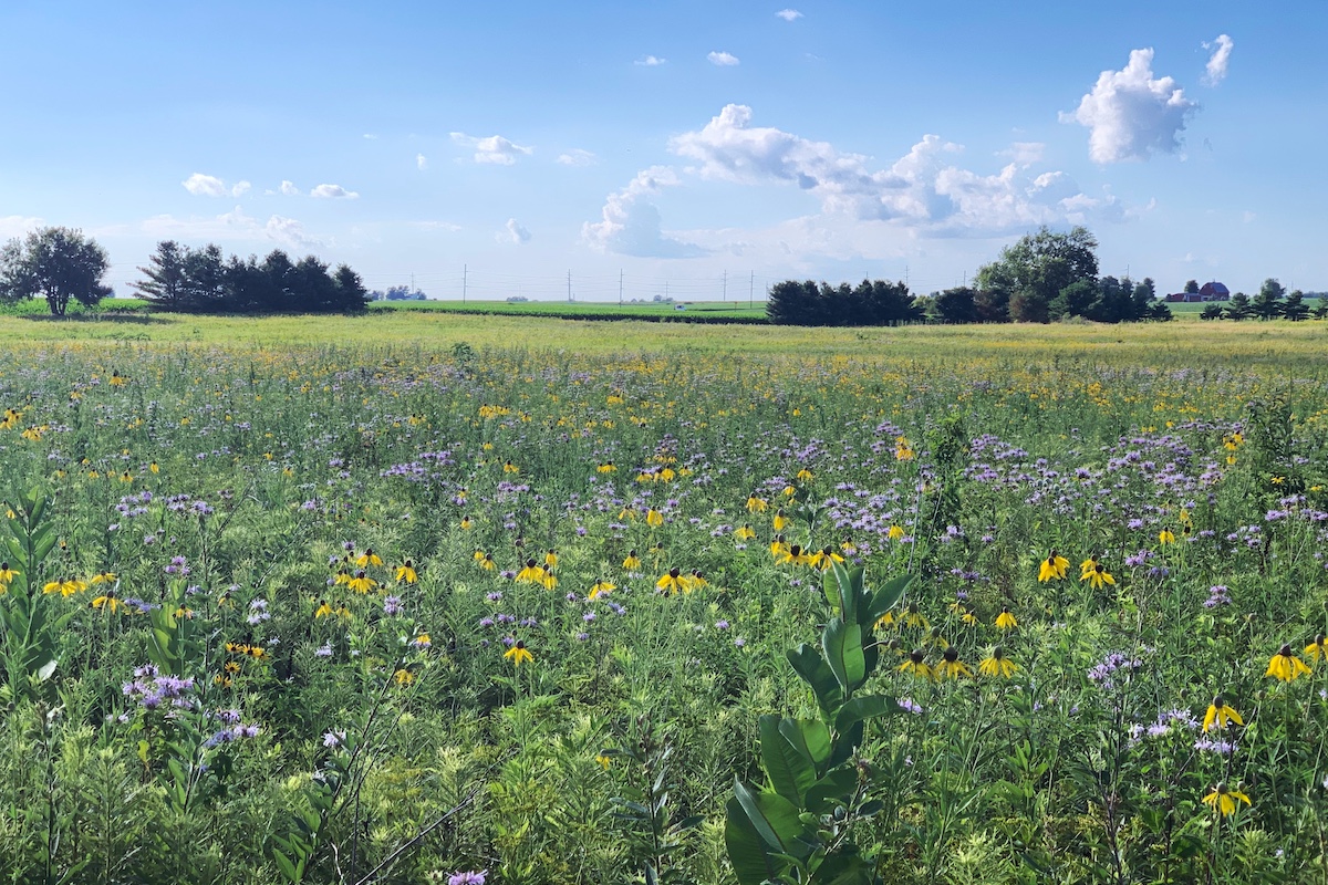
We made our way to the witness tree, the highlight of the hike and the purpose of my invite. There was no clear walkway. Spiderworts, purple coneflowers, penstemons and phloxes were in bloom. Prairie grasses, including little blue stem, side oats gamma and big blue stem, reached my hips. We chose our steps carefully through the vegetation and jumped over more spring runs.
The witness tree seemed even grander as we neared. Beneath its protection, sunlight filtered through the leaves causing a patchwork of dark and light. The tree called my attention to what had occurred on the landscape since the first land surveyors recorded this tree; the threats, the losses, and the recovery of rare ecosystems and the species that call them home.
I felt deep gratitude for the people who have worked so hard to ensure protections for the tree and surrounding natural communities for generations to come.
S.D. Shah is an illustrator, printmaker and nature journalist. She resides in Chicago. In 2020, Shah received her certificate in Traditional Botanical Art from the Chicago Botanic Garden. She is a novice but avid birdwatcher, hiker and native plant enthusiast. You can learn more about Sima and her work on her website.
John C. Nelson is a Natural Areas Preservation Specialist in northeastern Illinois for the Illinois Nature Preserves Commission. He helps legally protect, restore and manage nature preserves with public and private landowners.







Submit a question for the author