
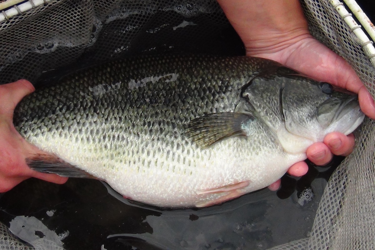
Lake trout, Salvelinus namaycush. Photo by Eric Engbretson, USFWS.


Lake trout, Salvelinus namaycush. Photo by Eric Engbretson, USFWS.

Lake trout (Salvelinus namaycush) were historically the top predator of the Great Lakes ecosystem. However, in the first half of the 20th century, increasing harvest by commercial fisheries had the population in Lake Michigan in decline. At this time, the invasive parasitic sea lamprey (Petromyzon marinus; an eel-like fish with a toothy sucker disc for a mouth) began to proliferate widely, leading to the ultimate demise of the lake trout population.
In 1965, a restoration effort began with the stocking of hatchery-reared lake trout at shoreline locations around the lake. After a decade, biologists proposed that it could be more effective to stock fish at their former offshore spawning grounds. They hoped that this would lead more fish to return to those locations as adults and reproduce successfully. At the time, however, relatively little was known about deep-water habitats in Lake Michigan and this change in stocking methods ignited efforts by biologists and geologists to scour historical fishing reports and take to the water to map the lake’s rocky reefs, ridges and shoals like never before. These efforts evolved over the years as scientists learned more and more about the spawning behaviors of lake trout and the incubation requirements of their developing eggs.
Over the years, successful stocking efforts created a large population of adult lake trout which contributed significantly to the lake’s sport fisheries but no substantial natural reproduction was seen. In the late 2000s, after 50 years of stocking, Illinois Department of Natural Resources (IDNR) biologists began seeing increasing numbers of naturally reproduced lake trout. Currently, the Illinois waters of Lake Michigan have the highest numbers of wild lake trout compared to any other region of the lake as they regularly comprise 60-70 percent of the catch in fall gillnet surveys (wild-born fish are identified by the lack of a fin clip given to all hatchery-reared fish before they are released).

This newfound occurrence of successful reproduction in southwest Lake Michigan and the subsequently growing population of wild fish led to increased interest in the distribution of spawning habitat in the Illinois waters. Previous efforts had identified some large reefs, most notable among them Julian’s Reef which was considered a “first priority” rehabilitation area and thus serves as an annual stocking location for lake trout. But fisheries managers were interested in what other potential spawning grounds were producing wild lake trout. This led the IDNR Lake Michigan Program to partner with scientists at the Illinois Natural History Survey (INHS) Lake Michigan Biological Station who had an offshore research vessel and side-scan sonar, a technology used to map bottom substrates. Side-scan sonar sends out high frequency sonar pings and analyzes the returning sound waves that are reflected off the lake bottom to create high-resolution sonar imagery.
Starting in 2017, INHS biologists used tips from historic reports and anglers to guide efforts to map a series of reefs ranging in depth from 30 to 240 feet. This series of reefs are located from 5 to 18 miles offshore, as far south as Winnetka and north to Zion. Depth maps of the different reefs were created and are available to the public on the Habitat tab of the Lake Michigan page of the IFishIllinois website. Substrate mapping has shown that, although these different reefs display similar structural patterns, they do not all exhibit equal potential as lake trout spawning habitat. Reefs like Lake Bluff 10-Mile and Gumby’s reefs have large patches of fractured bedrock debris, often near steep slopes, which contain the nooks and crannies, referred to as “interstitial spaces,” that lake trout seek to safely deposit their eggs. Others, such as North Reef, may contain scattered boulder- and cobble-sized rocks, but not in dense enough aggregations to help protect eggs which would be free to drift away in the bottom current.

Scientists also lowered underwater video cameras to confirm the structural observations made by the side-scan sonar and to assess the physical and ecological condition of the habitat. For example, like most hard bottom substrates in Lake Michigan, much of the rock they observed was encrusted with invasive quagga mussels (Dreissena bugensis). However, the degree of coverage at critical spawning substrates did vary from one reef to another. A number of fish were also observed utilizing these habitats, including many lake trout which tended to congregate on the summit of a reef, along steep slopes and drop offs, or in close proximity to patches consisting of piled boulders and cobble. Lake whitefish (Coregonus clupeaformis), a native species that historically supported abundant commercial fisheries, were observed at one reef. They were often seen feeding in schools along the bottom, sometimes in dense beds of dead quagga mussel shells that accumulate in low-lying areas. At another reef, schools of large freshwater drum (Aplodinotus grunniens) were observed surprisingly far from shore.
While seeking to document and describe potential lake trout spawning grounds, this research has given fisheries managers an unprecedented view of the offshore bottom habitats in the Illinois waters of Lake Michigan. Using a combination of side-scan sonar and underwater video it was possible to characterize wide swaths of lake bed and simultaneously make localized ecological observations providing useful insight into the benthic ecosystem.
The growing lake trout population contributes significantly to the diverse salmon and trout fishery of Lake Michigan. Boat anglers and charter boat operators tend to see lake trout in offshore waters, but lake trout also can be caught nearshore from piers adjacent to deeper water late in the year and early in the spring. Collaborative research and monitoring between IDNR and INHS will continue to be key to restoring the lake trout population and protecting this tremendous fishery resource for the anglers of Illinois.

William Stacy-Duffy is an aquatic ecologist with the Illinois Natural History Survey at the Lake Michigan Biological Station in Zion. He conducts research related to the lake trout fishery and deepwater habitat in Lake Michigan. He received his Bachelor’s degree in Fishery Biology from Colorado State University and Master’s degree in Natural Resource and Environmental Sciences from the University of Illinois at Urbana-Champaign.


Submit a question for the author